Overview of McCollum Park as a whole. In this map you will be able to see The park and ride, pool, bmx track.

 |
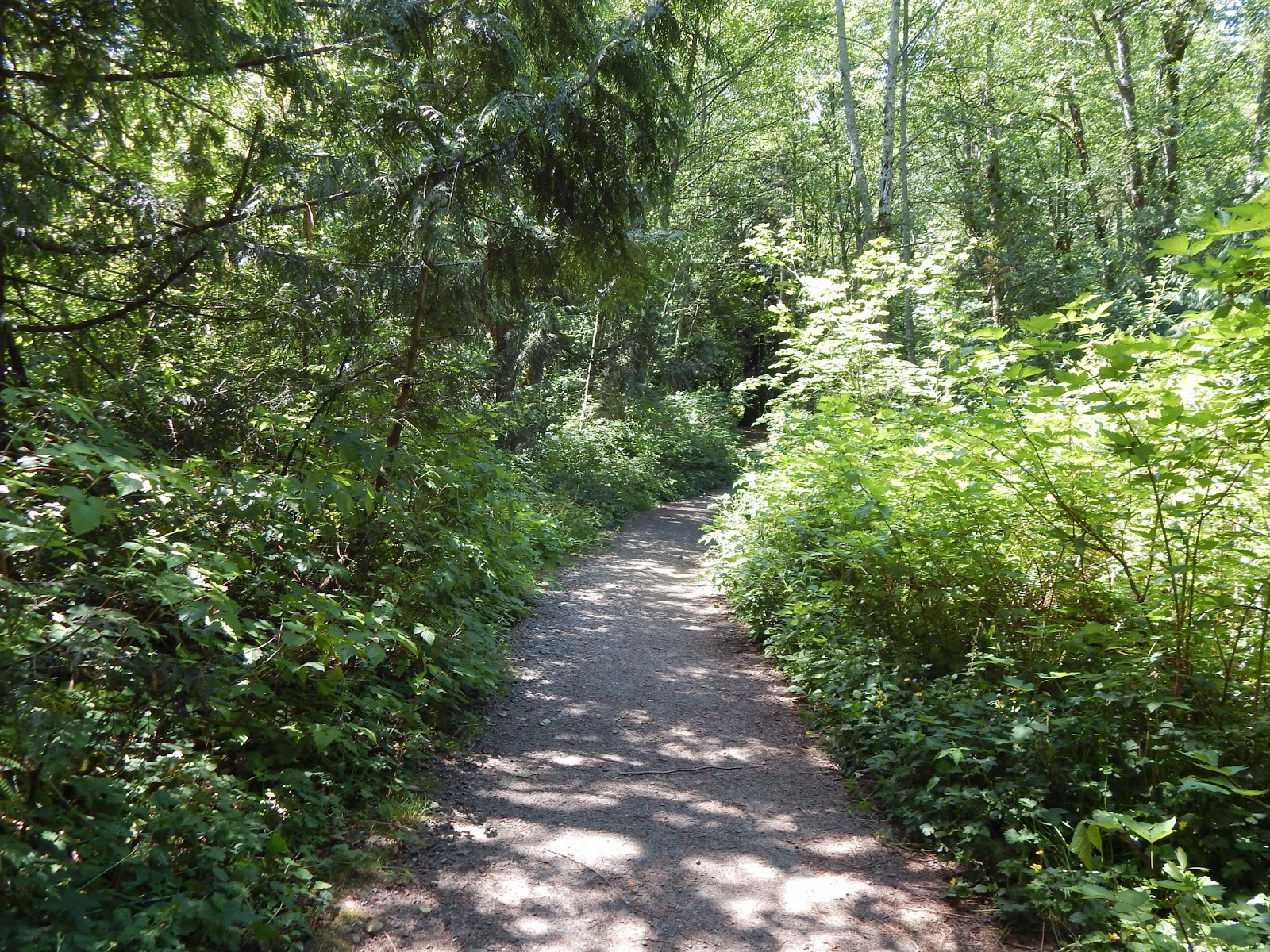
| Bridge you should start at. |
 Right in front of the bridge is our first stop. This is an easy area to identify some of the major trees in the area. Right in front is a Western Redcedar. Contrary to its name, it isn't really a cedar--it's actually in the cypress family. This is known as a false cedar because although the name has "cedar" in it, redcedar is actually one word not two (Chase, 2008).
 |
| Western redcedar: what you should be looking at |
Stop 2 Edibles:
If you turn to your left, you should be facing the path this way. This entire walkway is a treasure trove of edibles. For this station, we will be tasting some delicious (and not so delicious, but still edible) berries.
On the right, you will see a couple of salmonberries growing tall on the bushes. Salmonberries are native to the west coast, so it's not a surprise to see them lying around in this park. The berries grow in the springtime while the flowers start growing in the early spring. The berries are one of the earliest berries to grow (Pojar, 2004). You can see how the flowers are a pretty pink color with 5 petals. It's very frail looking. The leaves are in 3-leaflet bunches, sharply toothed at the edge, and somewhat soft. Now the berries are the star here. Pick your favorite berry of the bunch and feel it. Does it feel mushy or firm? Is it hairy or completely smooth? Does it smell sweet or like nothing at all? Finally, pop it in your mouth and savor the taste. If you picked a good one, it will be nice and sweet. If not, well... you can try again! But make sure you leave some for the birds!

A little fun fact: salmonberry is super popular among the northwest coast people. Both the sprouts and berries are edible. Young stem sprouts were gathered by the coast people and peeled and eaten raw, having a sweet and juicy flavor (Pojar, 2004). They were also steamed. Do you think you'd want to try to eat the stems?

Now this Red elderberry above is edible, but it doesn't taste good when it's raw and can cause nausea (Pojar, 2004). It's best to boil it or cook it, then make it into a tangy jam. Sounds yummy! You can collect them and cook it later. But make sure you don't get any leaves or stems--they have cyanide producing glysocides and are toxic! This berry was used widely with the coastal people too, but its popularity is dwindled nowadays.

With our tummies filled and mouths satisfied, lets go on to some listening exercises!
Site 3 Birds!
If you keep walking straight after our berry adventures, you will get to this fork in the road. You will stand where I marked the X on the picture, standing right in front of the Red alder, facing it. Now, look to the left (left of picture).

This area is a highlight of the forest loop. It's the central spot where birds tend to flock. Now, the spot may have been changed by people or the wind, but this is an unusual clearing with fallen branches and trees creating a half circle. But the open clearing makes it a nice spot for birds to hover around. There are always birds around this area, and really only this area is where you can find them. As you get deeper into the woods, you will here less birds.

Surrounded by lush salmonberry bushes, huckleberries, and thimbleberries, this area is a nice spot where birds like to hide and forage on the ground. The fruit bushes also make it a popular site among birds. There are tall 60-70 meter Douglas Firs and Red Alders around this area. This makes it a good place for birds that like to live in upper canopies to fly around.
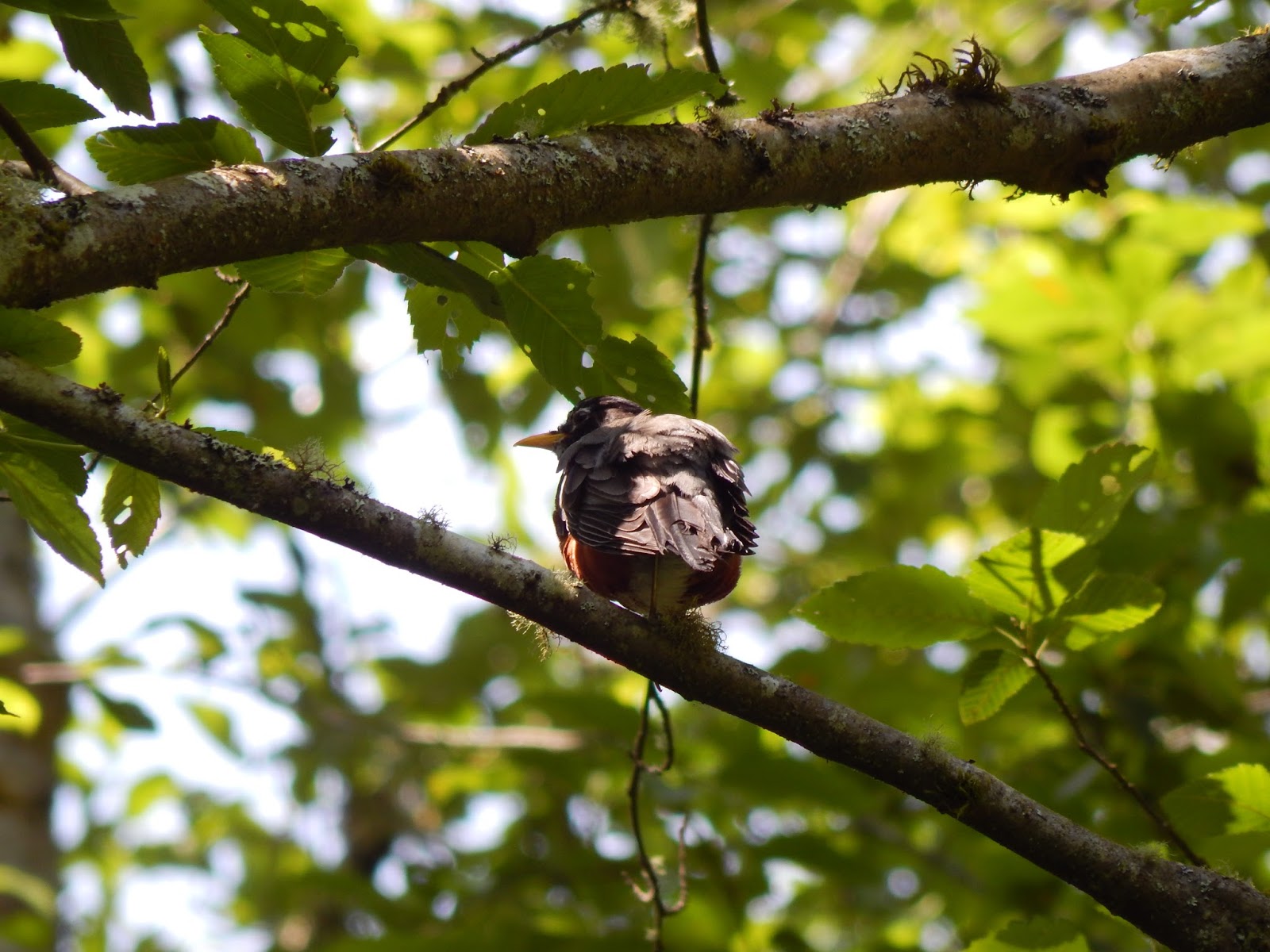 Close your eyes for a few minutes and listen to the calls of birds. Listen carefully--do you hear a high pitch little voice greeting you with "cheerily, cheerio, cheerily, cheerio"? This American Robin is very common in this area and sure does like to wake you with a greeting! Let's see if we can find it!
 This bird likes open woody areas, and you can find them chilling in the branches near this clear opening as well as on the lawns of the park. Its tummy is a rich orange-red color, and its feathers is gray on top. This truly is a common bird, and if you can't see it, at least you know its happy tune!

Do you hear a "wuk wuk wuk" that sounds like a dolphin? Or a pecking on wood? Most likely you are hearing a Pileated Woodpecker. Facing the opposite direction of the swamp a large Beech tree that is popular with woodpeckers. Here is one Pileated Woodpecker hopping down to try and find bugs. The Beech is split straight through the middle vertically, making it easy for the peckers to reach in and search for food. Listen for a "wuk wuk wuk" sound of the woodpecker. It sounds similar to a dolphin. It can also make a wood pecking sound.
 Another popular song you may hear is an upbeat, bouncy, happy introductory note, followed by a buzz and a trill. Most likely you're hearing a Song sparrow, since they're abundant in this part of the forest. Song sparrows can live in a variety of habitat, but they prefer having some trees or bushes for protection from predators. The male birds are territorial and aggressive because of the testosterone (Billo, 2016).
As we walk along the trail, in a couple of seconds we will reach the next highlight of our tour to the right. This area has a nice slew of species interacting with each other. Let's focus our attention to the Vine maple hosting the Cat-tail moss. As you can see, the heavy weight of the moss is actually shaping the maple's branches, causing it to droop downwards because it can't support the weight of the heavy moss. The relationship between the moss and maple is commensalism. While the maple is unaffected health-wise, the moss atop it is able to live on the maple's branches above the littered ground that would otherwise suffocate the moss by limiting the light that reaches it (McClaugherty, 1999). The maple isn't damaged, but it is shaped by the weight of the moss. Thus, the moss benefits while the maple remains unaffected. Moss likes to grow in moist, dense, shady environment, which this area is because of the creak and over head shadow from tree leaves and branches.

We're now going to leave the nest of lively birds and coolness of the moss, and enter the territory of the creepy-crawlies.

While walking, why don't you look up at the canopy and see the size of the trees. Although the trees are pretty tall, they are really skinny and look the same age.
Site 5: Inverts

It may not look it, but this central site is an invert paradise. The trailing shrubs host many spiders who make their webs in the middle of path ways. Be extra careful walking through the pathway, especially on sunny days, if you don't want to bring home a pet spider. In addition to spiders, there are interesting flying insects abundant in the area for the lack of flowers present. I have seen baby dragonflies, coleopteras (beetles), mosquitoes, and others flying around. It's no wonder that hummingbirds frequent this area even when there isn't much flowers around.
Let's go on an invert hunt and keep a running list of how many different insects you can find in this area. Go ahead and turn around rocks and tree, making sure to put them back the way you found so as not to destroy an organism's home. There are usually scurrying beetles hiding in the dark places. If you walk down more past the Western redcedar, you will hear part of the creek nearby. This place is an awesome area to find slugs! Behind this Western Redcedar tree is a Douglas-fir where banana slugs can sometimes be found.
Now, to leave the land of the creepy-crawlies and enter the land of the dead.
Site 6: Fungi Galore
Walking along the trail, keep left at the fork and don't make any turns out of the path. You will pass a lot of vegetation then come into a woody clearing. This small area averaging about 20 meters is devoid of understory vegetation--the only vegetation are the standing trees whose branches are cut and leaves are in the crown of the trees. There are a lot of downed small branches on the ground. But this area is the best place to find Red Belted Polypores, also known as Conks, on the trees. There are at least 10 conks in this entire area, signaling the death of these trees, since conks usually grow on dead wood. However, you can see that not all of the trees it's growing on is dead. Go up to one and see find one you can reach.


Now, since our next station is a nice walk away, take this moment to walk around and see and try to identify the plants you've already learned.
Site 7: Animal Behavior
Now that we've walked and have reached the fork where birds like to reside, we can look at animal behavior. Do you remember that Woodpecker who was using the Beech tree to find food? Well, if we're lucky we can see him hopping down and catching insects. But the highlight of this station is actually what the bird has built. If you look up into the tree a couple of feet away, you can see a large nest.

The nest looks too big to be a sparrow's or robin's nest. So perhaps it's a woodpeckers nest. Bird behavior is interesting when building a nest. It takes time and energy to build a nest, just like it does building a treehouse. Birds would like to stay near a constant food source that is easy to find, so that is why I think this is a Pileated Woodpecker's nest, mainly because this area has a lot of trees and I always here a woodpecker in this part of the woods.
Birds go out and slowly bring back twigs and leaves to build their nests. Since they can only carry so much in their beaks, it takes multiple trips to complete a nest. Looking at the nest, you can see how it's sitting on top of an 'X' that the Douglas-fir tree naturally made. This gives the nest stability and helps prevent it from being easily tipped over. The sign of a nest can mean a sign of the mating season also! Nests are made for eggs to stay put until they hatch. Then the parent birds would go back and feed them food they find.
As we make our way out of the forest loop, we will be back to that central redcedar near the bridge.
 |
| This should be the other pathway of the redcedar. This is the path if you were to start off by taking a right after the bridge. |

In the clearing, there are three tree trunks that appear to have been fallen due to causes not manmade. Let's visit the leftmost trunk. Look at the trunk at the top and you can see the jagged chips from where the top of the tree was separated from the bottom trunk. The trunk could have been disturbed by a windstorm, causing the tree to snap and fall. But also, look at the char at the base of the tree. It appears to be made by fire. All three trees share similar characteristics. Events aren't recorded about this forest since it is a pretty small park that isn't well known, so the best thing to do about this situation is to guess what happened. My guess is that there was a lightning storm that hit the trees, causing them to snap and fall, leaving behind a charred stump. Another hypothesis could be that the trunks were there and humans decided to light a fire in or on it, causing the char. But this hypothesis is the most unlikely. Either way, there was an ecological disturbance in this part of the woods because of the charring and jagged trunks that resemble wind-downed trees.

Site 9: Geomorphology
Leaving the tree fire area, we will walk and come upon a little clearing where the creek can be seen well. Here, we will observe the geomorphological change of the creak on the soil.
Go up to the creek and examine the rocks on the sides and inside the stream. Pick one up and examine it. Notice how its rounded and smooth instead of jagged and uneven. This is because of the stream shaping the rock, constantly smoothing out the edges for years until it became a nice, smooth rock. Abrasion occurs when the stream water and rocks collide, chipping away at the hard edges of the rock until eventually the sediment become rounded themselves (USGS, 2016).
Aside from the formation of rocks, the creek is also running downhill. With a natural hill aiding the water downwards, it erodes the soil bed in which the water lies on, deepening the creek bed. The water spans out to the sides of the bed, trying to erode the soil on the sides. However, the creek itself isn't so big. In fact, if you keep following the creek down, there is only traces of water. If you want to retrace your steps after the tour ends, go back to the beginning of the park where the bridge is. This is where the water disappears, but it's a great opportunity to see the shaping of the land by the water.

Look at the sides of the earth, where there's a line between the noticeably dry and noticeably wet ground. Although it isn't deep, you can see the indent the water left on the ground. The edges of the bank are hard and bold, but smoothed over. The water compressed the sediment underneath, eroding it (Science Clarified, 2016). Although this isn't much of a big change in geology, it is something fascinating to see, and is often times looked over.
Site 10: Land use history
The final site comes into view after following the path, where we see a grassy clearing with a shelter right in the middle. The northern region of this park was actually a landfill 46 years ago. There's no sign of this in the area, but records show it was a landfill. The surrounding area was known as Emander, named after Merril & Ring Lumber company who were the original landowner of the park property. (Romano, 2010). But locals calling themselves the Pioneers of Emander pushed for creation of a natural park, and so the Park was created (Romano, 2010) You can see the legacy of a lumber mill around by going through the tree clearing filled with Conks. The lack of an understory vegetation reveals the persistent use of manual clearing to keep the lumber area safe and intact. If you think back at the forest structure, you can tell how the forest is composed of similar sized trees efficiently placed linearly. After the park creation, the government capped the landfill and built a natural area over it, much like Seattle's Union Bay Natural Area near the University of Washington.

With very little historic background documented about this park, the best land use history is the current condition and my past historic use of it. I like to sit at this shelter because it gives the view of the park and people using it. Because of the Emander push to get a natural park built, we get a variety of amenities that make this park popular with locals. The BMX course was a new addition a couple of years ago to gain tourist attraction, because I never saw it when I was 11 years old. I've noticed that the forest path is maintained to keep it safe for the local high school cross country teams running through.
That's it for the tour! Feel free to walk around, retrace the trail steps, or hop into the public pool that we ended near. In case you are wondering, we are in the Northern part of the park while we started in the Southern part. So if you parked your car in the south part, you can take the road back to your parking spot. Alternatively, you can retrace your steps and take the scenic route through the forest back to your car.
References:
Chase, J. (2008). Western Redcedar, "Tree of life". Forests for Oregon. Retrieved from https://www.oregon.gov/ODF/Documents/ForestBenefits/WesternRedCedar.pdf
McClaugherty, C. (1999). Symbiotic relationships in the deciduous forest. Madsci Network: zoology. Retrieved from http://www.madsci.org/posts/archives/1999-03/921962728.Zo.r.html
Romano, C. (2010). Hike of the Week for Friday, April 16, 2010 McCollum Pioneer Park. Hike of the week. Retrieved from http://hikeoftheweek.com/McCollum_Pioneer_Park.html
Science Clarified (2016). Stream and river. Retrieved from http://www.scienceclarified.com/landforms/Ocean-Basins-to-Volcanoes/Stream-and-River.html
Snohomish County (2016). McCollum Pioneer Park. Parks and Facilities. Retrieved from http://snohomishcountywa.gov/Facilities/Facility/Details/McCollum-Pioneer-Park-43
USGS (2016). Earth's water: Rivers and streams. USGS Water Science School. Retrieved from http://water.usgs.gov/edu/earthrivers.html
No comments:
Post a Comment